Have you ever wondered How To Read GPS Coordinates? How do we know the exact location of the place we want to reach or where someone is just by using our smartphones? Or how you can keep track of the site of your loved ones no matter where they go or how your cab driver finds you exactly where you are. All this is done with the help of a well-organized and managed system called GPS.
GPS stands for Global Positioning System. In numerical notation, a minus sign preceding the second number signifies that the location is West of the prime meridian. Conversely, a minus sign preceding the first number indicates degrees south of the equator. Latitude coordinates measure the distance from the equator in the north and south directions.
In this article, we will discuss How To Read GPS. This includes what they are, their units, and how ordinary people can read them by understanding basic geographical terminology. Understanding and identifying these will allow you to Read GPS Coordinates. Click Here to know about GEOfinder Review
See Also: Top 3 IPhone Tracker Apps To Consider Using In 2024
Table of Contents
Basic Terms
You might have read or heard about How To Read GPS Coordinates in maps or movies.
They look like
27°10’3027°10’30 N
72°02’3172°02’31 E
OR
29°58’45.0329°58’45.03 N
31°8’03.6931°8’03.69 S
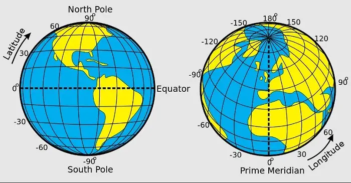
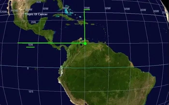
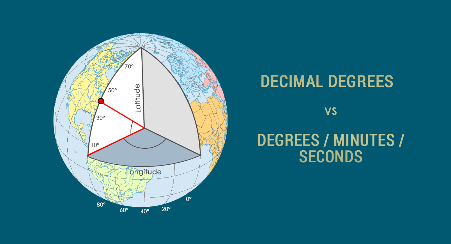
These coordinates include Degrees, Minutes, and Seconds respectively (they might also have milliseconds, to be exact).GPS coordinates are expressed in degrees rather than distance because Earth is a sphere divided or fractionated based on imaginary horizontal and vertical lines known as latitudes and longitudes.
These lines exist from West to East and North to South.
See Also: Oyster Vs. Scribd | Which Is Better? [Full Review]
Latitudes
The lines of latitude lie horizontally and are parallel throughout the globe; hence the distance between them remains constant.
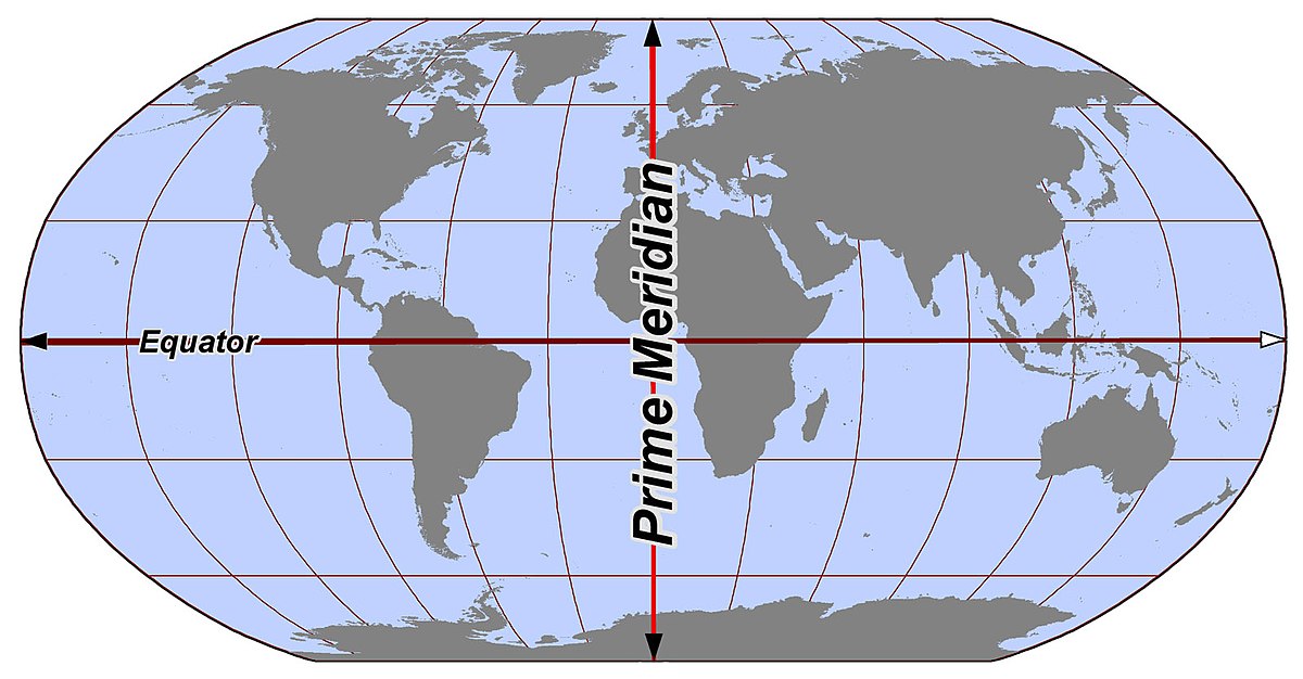
An imaginary line called the Equator bisects the globe horizontally, halfway between the north and south poles.
Equator
The Equator is at 0° latitude and runs west to east.
The northern part of the Equator is the northern hemisphere, and the southern part is the southern hemisphere.
90° N of the Equator lies the North pole, and 90° S of the Equator lies the South pole.
Longitudes
The lines of longitudes start at the north pole and meet back at the south pole; hence they are all around the poles and farther around the Equator.
A fictitious line known as the prime meridian divides the planet vertically.
It lies at 0° longitudes and runs from North to south, dividing the spheroid into 2 Hemispheres.
Prime Meridian
The Eastern part of the prime meridian is the eastern hemisphere, and the western part is the hemisphere of the West.
The prime meridian lies 180° north and south.
See Also: 9 Best Flight Tracker Apps For Android And iOS
Measurements
Each degree of latitude includes 60 minutes. The degrees of longitude and latitude can be measured in Nautical miles (1 nautical mile = 1.852 km)
A degree of latitude equals 60 nautical miles, i.e., each minute equals one nautical mile, which is constant as latitudes are parallel lines, and the same goes for longitude at the Equator. (note that the distance between degrees of longitude is not constant because they converge towards the pole)
Format
The popular format for reading and writing coordinates is DMS – Degrees Minutes and Seconds. This is one of the most crucial things to know if you want to know How To Read GPS Coordinates.
It is best to remember that all the lines of latitude above the Equator with the letter’ N” indicate a north direction. All the lines below the Equator with the letter “S” indicate the south direction.
Likewise, all the lines of longitude at the left of the prime meridian are written with the letter “W” to indicate a west direction, and all the lines at the right of the prime meridian are registered with the letter “E” to indicate the East direction.
Also, while noting directions, you register the coordinates of latitudes first, followed by longitudes.
The first degrees of coordinates are mentioned with a “°” followed by minutes and an apostrophe (“), and lastly, seconds (milliseconds too for details) with a quotation mark (“) followed by direction.
Note that while writing latitudes, N (North) or S (south) is mentioned, and while writing longitudes, E (east) or W (West) is mentioned.
(Note that there can be other formats too for writing coordinates that might not include commas, but the order remains the same, i.e., Degrees-Minutes-Seconds)
Example
Let’s take the example of the Coordinates of the White House, which are 38°58’51.61 “38°58’51.61” N, 77°02’11.58 “77°02’11.58” W.
In latitudes, 38 degrees is actually 58 minutes and 51.61 seconds in the North. Likewise, in longitudes, it is 77 degrees, 02 minutes, and 11.58 seconds in the West.
GPS Accessories
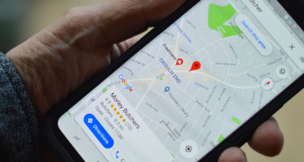
Google Maps is the most popular and convenient way to find out and know How To Read GPS coordinates.
It is the easiest way to locate any place on Earth, just with the help of coordinates.
Other than that, GPS devices are also in various automobiles and aviation instruments. Read this article on how you can add fonts to GIMP.
WORKINGS OF GPS NAVIGATION
The present GPS constellation was approved by the Department of Defense (DOD) in 1973, and satellite launches for the constellation started five years later. In 1993, the system was fully functional. Even now, the DOD employs it to assist with anything from missile guidance to helping soldiers navigate foreign environments. Additionally, GPS has been available to civilians for more than 30 years, which has been immensely helpful.
Devices use low-power radio waves to communicate with the GPS satellites. That rapid communication helps us precisely determine any position in the type of GPS coordinates due to their perfect placement and extraordinary travel speed.
DEGREES, MINUTES, AND SECONDS (DMS)
Each line of longitude or latitude is divided into 60 minutes into the degrees, minutes, and seconds (DMS) system, and each minute is divided into 60 seconds.
This idea may appear perplexing because it relates constant coordinates to time, yet it’s widely used.
DEGREES AND DECIMAL MINUTES (DMM)
Another style for expressing GPS coordinates is degrees and decimal minutes (DMM), which divides the time between each line of longitude or latitude into 60 minutes and then breaks each minute down into decimals.
In this format, the Eiffel Tower’s coordinates are 48° 51.504′ N and 2° 17.67′ E. You would read these coordinates as 48 degrees, 51.504 minutes north, and 2 degrees, 17.67 minutes east. Although these coordinates are easier to pronounce because they don’t require calculating minutes and seconds independently, this is the least used format for presenting GPS coordinates.
Check out: What Is A Good Internet Speed? Everything You Should Know
DECIMAL DEGREES (DD)
The third, most accessible, and possibly most used format for describing a combination of GPS coordinates in decimal degrees (DD). This format splits the distance between every line of latitude or longitude across 60 decimals, removing the uncertainty of minutes or seconds, even if it can provide a huge fractional component.
Format conversion across DMS and DD
You can convert from the Degree, Minute, and Seconds (DMS) and Decimal Degree (DD) formats with the help of several online resources.
Mathematicians can understand how to switch from DMS to DD and simultaneously if they are ready to complete the necessary calculations.
Websites that offer rapid transformation between DMS and DD are accessible. Click here for the best 4 methods on how to factory reset Xbox One X.
FAQs
What do the coordinates' numbers mean?
A global address is given in the form of two digits termed coordinates—the latitude and longitude of a required location.
Which coordinates should be in which order?
Longitude latitude comma longitude Latitude, equator longitude, common attitude: a quitter. Therefore, the latitude and longitude are the proper order for coordinates, as we can state unequivocally.
A coordinate diversifies in one of three ways
A coordinate with an integer for degrees, a real number for minutes, and an integer for seconds (DMS). It contains minutes (a real number) and degrees (an integer) (MinDec). Only-degrees-in-the-coordinate (actual number) (DegDec).
What is the accuracy of coordinates?
At the equator, a decimal degree value is accurate to five decimal places and 1.11 meters. The precision of the longitude portion of the coordinates rises as you move away from the equator since the Earth is spherical and not flat. The latitude component's precision remains unchanged.
Conclusion
These apps allow you to Read GPS Coordinates efficiently. Hope these methods work according to your preferences. Also, learn how to unshare data on Glo.
Thank you for reading!
